 Evening thunderstorms, some severe; storms can bring downpours, large hail and damaging winds. A Flash Flood Watch is in effect until Tuesday morning at 7am. Please listen to WRCO Radio or your favorite TV news channel for up to date changes in the weather.
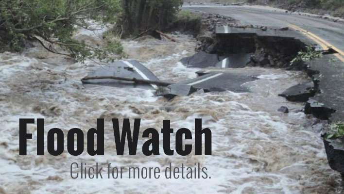
Flash Flood Watch 6/1/2014
Potential for Flash flooding through early Monday afternoon.
Numerous showers and thunderstorms have developed across the Upper Mississippi River Valley Region today, dumping anywhere from 1/4 of an inch to as much as 3 inches per radar estimates as of 2:30 pm. The showers and thunderstorms could diminish briefly this evening, but then another round of showers and storms will roll into the region from the west. From the rest of this afternoon through early Monday afternoon, an additional 1/2 inch to 2 inches of rainfall is possible. This additional rainfall combined with what has fallen may result in flash flooding. [Read more…]
Special Statement – 5/27/2014
A line of strong thunderstorms moving through southwest Wisconsin…
At 805 PM…a line of strong thunderstorms extended from near Tomah Wisconsin to Platteville. The heaviest rain was falling from near Hillsboro through the Richland Center area…but moving east.
Be prepared for very heavy rain that could produce localized street flooding or bring ditches up to Road levels. In addition frequent lightning will be present so move indoors and avoid standing near or under trees.
Wisconsin’s Tornado & Severe Weather Awareness Week
Listen, Act and Live! Those words could protect you and your family during severe storm season. Listening to warnings and seeking shelter immediately will save lives. That’s why Wisconsin Emergency Management (WEM), ReadyWisconsin, the National Weather Service (NWS) and the Wisconsin Broadcasters Association (WBA) have teamed up for Wisconsin’s Tornado and Severe Weather Awareness Week April 21-25, 2014.
Did you know that…
• Wisconsin averages 23 tornadoes annually.
• In 2013, 16 tornadoes touched down in Wisconsin including six during the night and early morning hours of August 6-7 when an EF2 struck near New London in Waupaca and Outagamie counties. That tornado injured two residents and caused millions of dollars in damage.
• In 2012, only 4 tornadoes were reported in Wisconsin by the NWS. The strongest tornado hit near Patch Grove in Grant County on September 4. No fatalities or injuries were reported.
• In 2011, 38 tornadoes in Wisconsin were confirmed by the NWS, the fourth highest number on record. On August 19, a man was killed when a tornado with winds of 105 mph struck Marinette County.
• The peak tornado season in Wisconsin is April to August, but tornadoes can occur any time of year, like the January 7, 2008 storms near Kenosha.
Flood Warning for Richland County, WI
…until 11:15 PM CDT, Sun., Apr 13, 2014
THE NATIONAL WEATHER SERVICE IN LA CROSSE HAS ISSUED A
* SMALL STREAM FLOOD WARNING FOR… CLAYTON COUNTY IN NORTHEAST IOWA… RICHLAND COUNTY IN SOUTHWEST WISCONSIN… CRAWFORD COUNTY IN SOUTHWEST WISCONSIN… GRANT COUNTY IN SOUTHWEST WISCONSIN…
* UNTIL 1115 PM CDT
* AT 815 PM… THE PINE RIVER IN RICHLAND COUNTY WISCONSIN WAS GOING OUT OF ITS BANKS AND THERE WAS A REPORT OF A MUDSLIDE. RAINFALL FROM THE DAY WAS APPROACHING 2 INCHES AND WITH THE EXCESSIVE RAIN FROM LAST NIGHT… MORE WATER PROBLEMS ARE EXPECTED THIS EVENING.
* SOME LOCATIONS THAT COULD EXPERIENCE FLOODING INCLUDE… PLATTEVILLE… PRAIRIE DU CHIEN… RICHLAND CENTER… LANCASTER… BOSCOBEL… GUTTENBERG… ELKADER… SOLDIERS GROVE… FENNIMORE… POSTVILLE… CUBA CITY… MONONA… MUSCODA… STRAWBERRY POINT… HAZEL GREEN… DICKEYVILLE… CASSVILLE… MCGREGOR… GARNAVILLO AND BLOOMINGTON.
PRECAUTIONARY/PREPAREDNESS ACTIONS…
MOST FLOOD DEATHS OCCUR IN AUTOMOBILES. NEVER DRIVE YOUR VEHICLE INTO AREAS WHERE THE WATER COVERS THE ROADWAY. FLOOD WATERS ARE USUALLY DEEPER THAN THEY APPEAR. JUST ONE FOOT OF FLOWING WATER IS POWERFUL ENOUGH TO SWEEP VEHICLES OFF THE ROAD. WHEN ENCOUNTERING FLOODED ROADS MAKE THE SMART CHOICE… TURN AROUND… DONT DROWN.